 In each “Sentry Story,” we’ll describe an actual flight and share the view out the window and ForeFlight screenshots. You’ll see how Sentry can be used to make flying safer and easier, plus you’ll learn some tips for flying with datalink weather. Want to share your story? Email ipad@sportys.com.
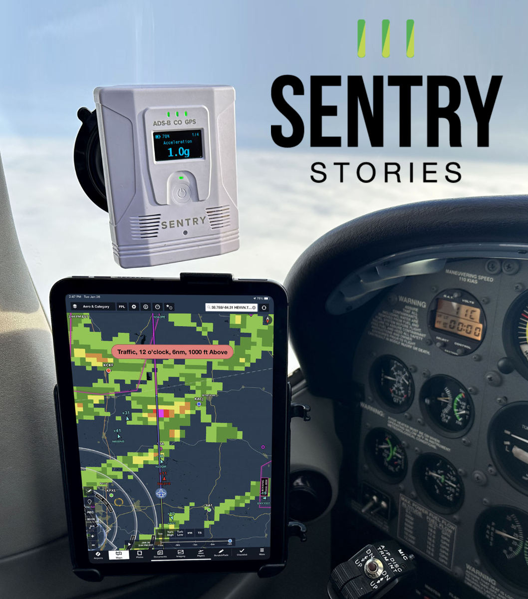
Learn more about the Sentry line of ADS-B Receivers:
Sentry Mini>>
Sentry>>
Sentry Plus>>
Sentry Story #4
Date: July 27, 2023
Aircraft: Cessna 182
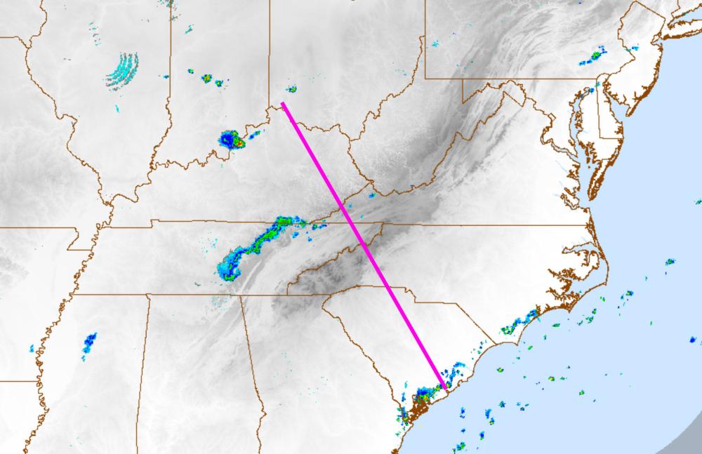
Route: I69 to KCHS
Flight rules: IFR
Altitude: 9,000
The Cessna 182 is one of my favorite single-engine piston airplanes, thanks to its ease of operation, generous payload and 140-knot cruise speed. In just under 3 hours, it can take you and your family from the rural farm fields of Ohio to the beaches of South Carolina while staying comfortable and cool over the Appalachian Mountains at 9,000 feet.
That was my exact mission one day in late July: to fly to Charleson, SC, with my family and visit friends over a long weekend. Since high pressure was forecast for most of the route, we planned to leave around noon, knowing we wouldn’t have to deal with convection over the mountains during the hottest part of the day.
The only wild card in the weather briefing was the vague “VCTS” line in the Charleston TAF for my arrival time, standing for “Thunderstorms in the Vicinity.” Digging further into the textual Aviation Forecast Discussion for the destination revealed that upper-level moisture would move inland from offshore, creating storm cells with heavy downpours.
There wasn’t much organization in the system, and the activity wasn’t forecast to move too far inland, so I planned to watch the storm development during the flight. If a cell decided to park itself over Charleston International during the arrival, I’d divert to one of the surrounding airports and wait it out.
The first 400 miles of the 422-mile trip were uneventful and offered great sightseeing over the mountains of Tennessee and North Carolina. I used a Sentry ADS-B receiver and an iPad Mini running ForeFlight to keep an eye on the storm development around Charleston as we got closer.

As forecast, the cells stayed somewhat spotty and drifted slowly towards the northwest, away from the ocean, but remained clustered around the destination airport. About 100 miles out, you could see the tops of the stronger cells around Charleston rising above the cumulus clouds. 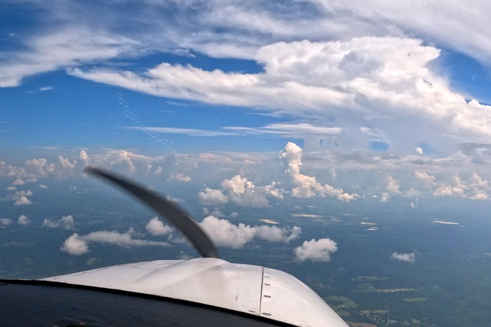
There were plenty of gaps in between the smaller cumulus buildups, allowing for a smooth descent. I made it a point to descend to a lower altitude further out than I usually would to get below the cloud bases and maintain visual separation with the precipitation.
The ILS Runway 15 approach was in use at Charleston, and I could hear numerous airplanes on the approach frequency working their way around the weather ahead of me. Unfortunately, I was the slowest in the mix, leading ATC to vector me way out to the east as they sequenced the faster corporate and airline traffic onto the ILS ahead of me. By the time ATC turned me back toward the final approach course, ForeFlight’s ADS-B radar layer showed that the cell was continuing to drift north away from the airport.

While the edge of the precipitation returns hugged the final approach course, the ADS-B traffic layer showed the airplanes ahead of me flying the ILS without deviations or remarks on the approach frequency, which was a good sign.
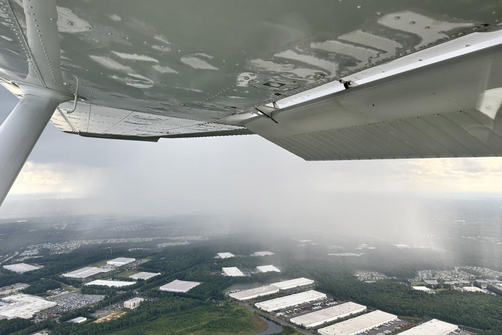
But the view out the front told the story the best. Visibility was excellent, and the rain shafts were well-defined, providing a clear path forward to the airport (KCHS is on the far left of this image):
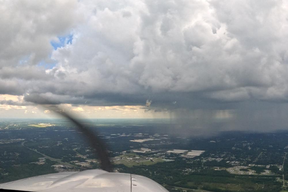
If the circumstances were different and these cells were obscured by clouds or low visibility, flying the same path in instrument conditions along the ILS close to the cell could be risky.

But in this case, I had a clear view of the precipitation, and by the time I was on the final approach segment, the cell had already moved several miles further away. Remember, the radar image is likely 10 to 15 minutes old, so your eyes always win when comparing what you see on your iPad vs. the view out the window.
There wasn’t so much as the slightest bump from that point on to landing. We looked straight into blue skies during landing and taxied past a diverse mix of 787s, F35s, and C-17s at the joint-use Air Force Base.
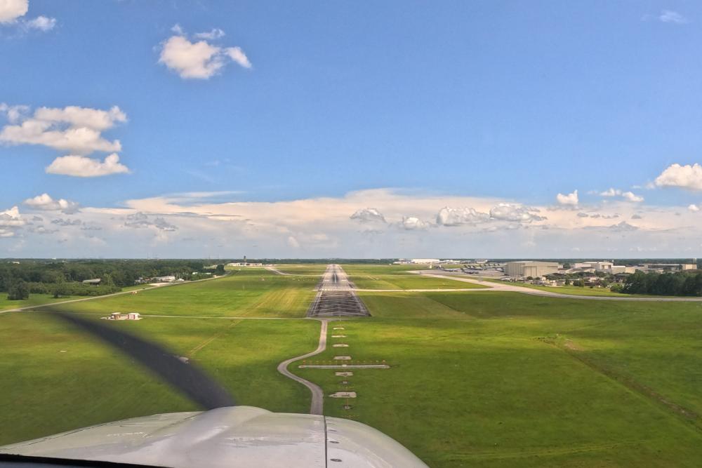 The puddles on the ramp and humid conditions while unloading were a good reminder that our arrival timing was more luck than skill. If we had shown up 20 minutes earlier, we likely would have had to divert to one of the satellite airports or enter a holding pattern while the precipitation moved through. However, both options would have been non-events, thanks to the continuously updated weather information provided by the Sentry ADS-B weather receiver and ForeFlight.
Want to share your story? Email ipad@sportys.com for a chance to be featured in one of our Sentry Stories.
Learn more
Read every edition of Sentry Stories here
Sentry line of ADS-B Receivers: