 In each “Sentry Story,” we’ll describe an actual flight and share the view out the window and ForeFlight screenshots. You’ll see how Sentry can be used to make flying safer and easier, plus you’ll learn some tips for flying with datalink weather. Want to share your story? Email ipad@sportys.com.
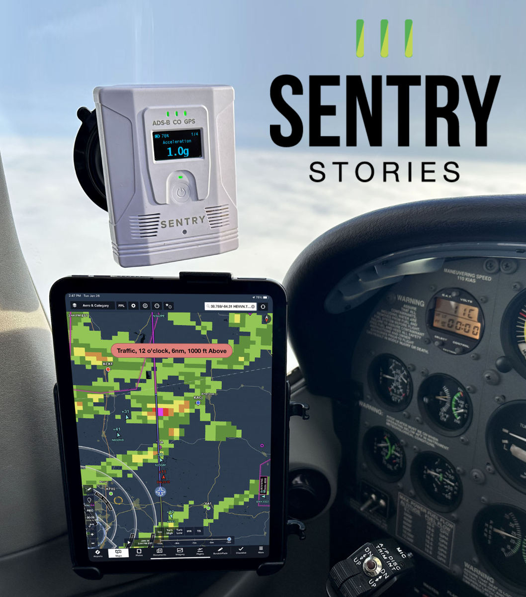
Learn more about the Sentry line of ADS-B Receivers:
Sentry Mini>>
Sentry>>
Sentry Plus>>
Sentry Story #3
Date: June 7, 2024
Aircraft: Pilatus PC-12
Route: KCOS to KLUK
Flight rules: IFR
Altitude: 27,000
Some pilots think ADS-B weather is mostly for piston airplanes. Don’t turbine airplanes climb high enough to get above the worst weather? And don’t they have onboard radar to help deviate around thunderstorms? Yes, turboprops and jets can climb well into the flight levels, and yes, they usually have onboard radar for real-time weather avoidance. But datalink weather is still essential equipment. This trip was just the latest example for me.
The flight plan in ForeFlight showed a roughly 1000-mile route, from Colorado Springs to Cincinnati. Weather was excellent at the departure and destination airports, but as is common when crossing the country, a line of weather was draped across Kansas. It didn’t look like much, but there was enough orange and red to get my attention.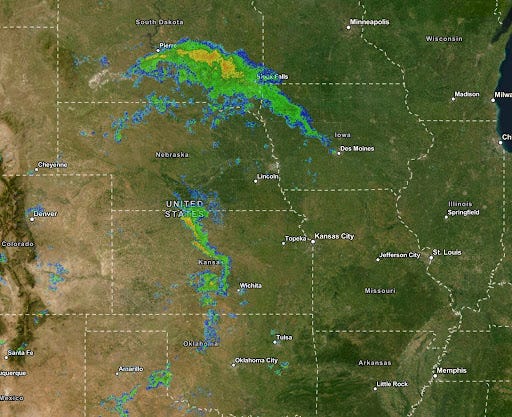
I departed into beautiful blue skies, with the snow-capped Rocky Mountains off the right wing, and started heading east. I knew I would need to get closer to that line of weather before making a decision about which way to go, so for now I stayed on course, which was essentially direct. This particular Pilatus PC-12 is not RVSM approved, so 27,000 feet was as high as I could go today—and I took it. Altitude is almost always a good thing when navigating around convective activity since you can get above the low-level weather and see the truly nasty stuff more clearly.
The ADS-B radar was showing the lower resolution national image up in the Dakotas, but most of the line of Kansas was already coming in at the higher resolution regional image. I couldn’t help but notice the lightning symbols:

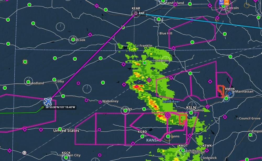
Approaching the line of weather, it looked like there was a nice gap south of our route, with just scattered green on the radar. For at least 10 minutes I considered taking this option since it was very nearly on our direct course, and often 27,000 means you’re above green radar returns. But two things changed my mind. First, when I animated the radar (always a good idea!) I discovered that the line was actually moving from north to south. That meant I would be racing the front side of the worst weather, which is never a good place to be. I always prefer to deviate around the upwind side of a serious storm if possible. What if that line filled in as the front side of the storms moved south?
Second, the view out the window didn’t look great. Maybe those clouds were just light rain, but the tops appeared to be above my altitude and I didn’t relish the idea of going IMC while deviating around storms. I thought I could also see the tops continuing to grow, suggesting vertical development that might change conditions by the time I got there. In short, it just didn’t look right to me.
Given that, I ignored my strong instinct to save time and started planning a detour. As I like to do in scenarios like this, I didn’t try to thread the needle around cells; I simply changed my flight plan by dragging my course line clear of the weather. This is fast and easy in ForeFlight, and Kearny, Nebraska soon appeared under my finger. That became the new fix, so I called Denver Center and asked to change my flight plan route to EAR - KLUK. That was quickly approved.
As we swung around the north end of the weather, I felt great about my decision. This may have been a fairly small line, but it was still growing—I could see the tops of the clouds billowing upward even on the backside. There might have been a path through, but it was far from guaranteed and I was personally quite happy with the smooth ride I was enjoying. I simply stayed visual and deviated north to avoid the tallest clouds, confident that I always had a guaranteed out if I needed it by going further north.
Once we were east of the line—which took a while as storms continued to fill in over Nebraska, we entered direct-destination and enjoyed an easy flight home. ATC was accommodating as usual and I didn’t end up logging a single minute of actual IMC.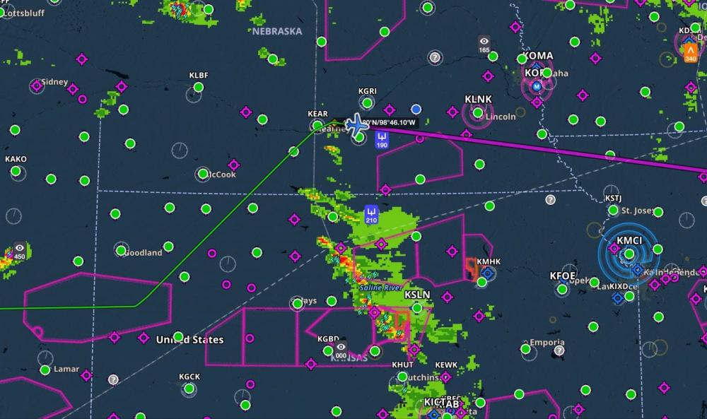
This trip reinforced the right way to use datalink weather: for long-range, large-scale deviations and not close-in storm penetration. Instead of stressing about 10 degrees left and 20 degrees right, bouncing through building cumulus clouds, I simply avoided the whole mess. ForeFlight’s powerful Maps page and intuitive touch planning makes it so easy to evaluate different options and change your flight plan route. Once you’ve done that work, communicating your new plan to ATC is easy.
Besides, after all that, my big detour cost me all of 10 minutes. In my book, that’s a great trade.
Want to share your story? Email ipad@sportys.com for a chance to be featured in one of our Sentry Stories.
Learn more
Read every edition of Sentry Stories here
Sentry line of ADS-B Receivers: